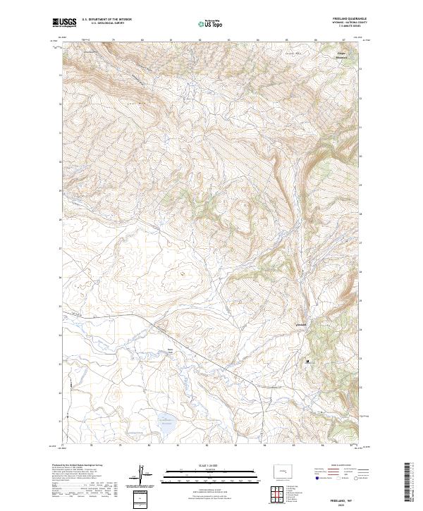
2023 Map of Freeland
USGS Topo · Published 2023About this map
Freeland sits at the base of the high country in Natrona County, where the northern slopes of Casper Mountain and Coal Mtn give way to the sprawling landscape of Bates Hole. This topographic survey reveals a rugged transition zone defined by deep drainage systems like Jackson Canyon and Gotheberg Draw. The local geography is anchored by the historic Freeland Cem, a vital landmark for genealogists and local historians tracing the early ranching families of this high-plains region. Hydrology in the area is dominated by the winding paths of Little Red Creek and Bates Creek, which eventually reach Schnoor Reservoir. Transportation routes like the Old Casper Medicine Bow Hwy and Two Bar Rd follow the natural contours of the land, providing a clear picture of how early travel corridors evolved alongside the area's complex terrain.
Find a feature on this map
28 named features on this map. Tap any name to fly to it.
Don’t see what you’re looking for? This feature index may not catch every label — zoom into the map to look around manually.
Map Details
Editions of this 2023 Freeland Map
This is the sole edition of this map. No revisions or reprints were ever made.
Other maps of this area

1950 · Emigrant Gap
USGS Topo · 1:24,000

1950 · Goose Egg
USGS Topo · 1:24,000

1950 · Alcova SE
USGS Topo · 1:24,000

1951 · Casper
USGS Topo · 1:24,000

1951 · Bessemer Mountain
USGS Topo · 1:24,000

1955 · Casper
USGS Topo · 1:250,000

1958 · Casper
USGS Topo · 1:250,000
1960 · Emigrant Gap
USGS Topo · 1:24,000

1960 · Twin Buttes
USGS Topo · 1:24,000

1960 · Crimson Dawn
USGS Topo · 1:24,000