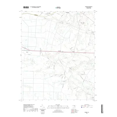
2019 Map of Freeman
USGS Topo · Published 2019About this map
East Arcadia and the surrounding rural landscape of Bladen and Columbus counties are defined by an intricate network of waterways and low-lying basins. The terrain transitions from the open waters of Broadwater Lake and the wetlands of Big Bay to a series of engineered drainage features like the Strauss Canal and Lateral Canal E. These canals suggest a history of managing the damp coastal plain for agricultural and residential use.
Find a feature on this map
77 named features on this map. Tap any name to fly to it.
Don’t see what you’re looking for? This feature index may not catch every label — zoom into the map to look around manually.
Map Details
Editions of this 2019 Freeman Map
This is the sole edition of this map. No revisions or reprints were ever made.
Other maps of this area

1942 · Juniper Creek
USGS Topo · 1:24,000

1943 · Honey Island
USGS Topo · 1:24,000

1943 · Lewis Swamp
USGS Topo · 1:24,000

1944 · Lewis Swamp
USGS Topo · 1:31,680

1953 · Florence
USGS Topo · 1:250,000

1954 · Florence
USGS Topo · 1:250,000

1954 · Acme
USGS Topo · 1:62,500

1954 · Bolton
USGS Topo · 1:62,500
1980 · Acme
USGS Topo · 1:24,000
1980 · Lewis Swamp
USGS Topo · 1:24,000