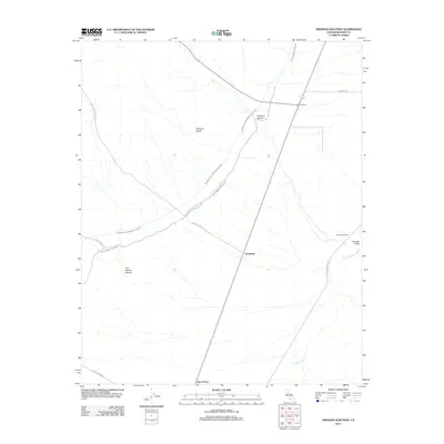
2012 Map of Freeman Junction
USGS Topo · Published 2012About this map
Robbers Roost dominates the high ground in this portion of Kern County, overlooking a landscape defined by critical water infrastructure and remote desert settlements. The strategic positioning of Los Angeles Aqueduct and the Second Los Angeles Aqueduct illustrates the monumental engineering required to move water across this arid terrain. Small stopping points and junctions like Freeman, Armistead, and Harts Place mark the thin line of human habitation along the highway corridors. The map also captures the varied topography of the region, from the depths of Cow Heaven Canyon and Freeman Canyon to the drainage of Little Dixie Wash. Traces of ranching history are evident at Black Hills Corral, while the network of unpaved routes such as Cow Heaven Canyon Rd and Sage Canyon Rd suggests the difficulty of navigating this isolated high-desert environment.
Find a feature on this map
17 named features on this map. Tap any name to fly to it.
Don’t see what you’re looking for? This feature index may not catch every label — zoom into the map to look around manually.
Map Details
Editions of this 2012 Freeman Junction Map
This is the sole edition of this map. No revisions or reprints were ever made.
Other maps of this area

1906 · Kernville
USGS Topo · 1:125,000

1908 · Kernville
USGS Topo · 1:125,000

1915 · Searles Lake
USGS Topo · 1:250,000

1915 · Mojave
USGS Topo · 1:125,000

1943 · Inyokern
USGS Topo · 1:62,500

1943 · Cross Mountain
USGS Topo · 1:62,500

1943 · Saltdale
USGS Topo · 1:62,500

1943 · Onyx
USGS Topo · 1:62,500

1947 · Trona
USGS Topo · 1:250,000

1948 · Trona
USGS Topo · 1:250,000