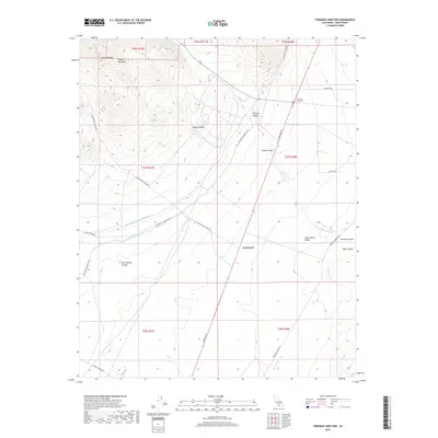
2018 Map of Freeman Junction
USGS Topo · Published 2018About this map
The high desert landscape of Indian Wells Valley meets the southern foothills of the Sierra Nevada in this topographical study. Central to the region's infrastructure is the dual-line engineering of the Los Angeles Aqueduct and the Second Los Angeles Aqueduct, which cut diagonally across the arid terrain near Armistead. The junction of modern transit and historical routes is visible at Freeman Junction, where the Midland Trl and various canyon roads converge. To the northwest, the Scodie Mountains provide a dramatic elevation change, sheltering landforms like Robbers Roost and the drainage of Cow Heaven Canyon. This area serves as a critical corridor for water management and transportation between the mountain passes and the open Mojave Desert. Local water sources such as Big Spring and the ephemeral Little Dixie Wash highlight the sparse but vital hydrology of this Kern County region.
Find a feature on this map
29 named features on this map. Tap any name to fly to it.
Don’t see what you’re looking for? This feature index may not catch every label — zoom into the map to look around manually.
Map Details
Editions of this 2018 Freeman Junction Map
This is the sole edition of this map. No revisions or reprints were ever made.
Other maps of this area

1906 · Kernville
USGS Topo · 1:125,000

1908 · Kernville
USGS Topo · 1:125,000

1915 · Searles Lake
USGS Topo · 1:250,000

1915 · Mojave
USGS Topo · 1:125,000

1943 · Inyokern
USGS Topo · 1:62,500

1943 · Cross Mountain
USGS Topo · 1:62,500

1943 · Saltdale
USGS Topo · 1:62,500

1943 · Onyx
USGS Topo · 1:62,500

1947 · Trona
USGS Topo · 1:250,000

1948 · Trona
USGS Topo · 1:250,000