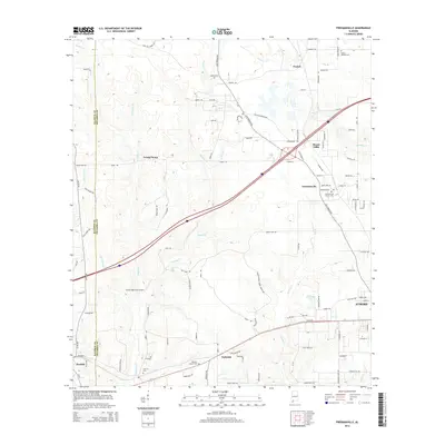
2014 Map of Freemanville
USGS Topo · Published 2014About this map
Poarch and Freemanville anchor this 2014 survey of the Alabama-Florida borderlands, where the landscape is defined by the winding course of the Perdido River and its numerous tributaries. This modern record of Escambia and Baldwin counties illustrates a transition from the agricultural operations of Ewing Farms to the northern outskirts of Atmore. The map is particularly useful for genealogical research, documenting several local burial grounds including the Poarch Mission Cem, Judson Cem, and Nokomis Church Cem.
Find a feature on this map
112 named features on this map. Tap any name to fly to it.
Don’t see what you’re looking for? This feature index may not catch every label — zoom into the map to look around manually.
Map Details
Editions of this 2014 Freemanville Map
This is the sole edition of this map. No revisions or reprints were ever made.
Other maps of this area

1941 · Century
USGS Topo · 1:62,500

1942 · Perdido
USGS Topo · 1:62,500

1942 · Dyas
USGS Topo · 1:62,500

1943 · Century
USGS Topo · 1:62,500

1944 · Dyas
USGS Topo · 1:62,500

1944 · Perdido
USGS Topo · 1:62,500

1953 · Andalusia
USGS Topo · 1:250,000

1957 · Andalusia
USGS Topo · 1:250,000

1957 · Pensacola
USGS Topo · 1:250,000

1959 · Pensacola
USGS Topo · 1:250,000