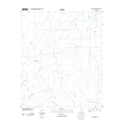
2013 Map of Freemound
USGS Topo · Published 2013About this map
Freemound serves as a central point in this rural landscape within North Texas, where the terrain is heavily defined by the upper reaches of the Elm Fork Trinity River and its numerous tributaries. The area is marked by a complex network of creeks and branches, including Clear Cr, Blocker Cr, and Wheat Cr, which create a highly dissected topography typical of the Cross Timbers region. Energy extraction is a prominent feature of the local economy and land use, as evidenced by the distribution of the Voth Oil Field, Gatewood Oil Field, and Dangel Oil Field. The infrastructure is primarily composed of county roads like Co RD-341 and farm-to-market routes such as FM-1630, connecting isolated ranch lands and agricultural properties. This map offers a clear view of how water drainage patterns and petroleum interests have shaped the settlement and road layout in this part of Cooke County.
Find a feature on this map
36 named features on this map. Tap any name to fly to it.
Don’t see what you’re looking for? This feature index may not catch every label — zoom into the map to look around manually.
Map Details
Editions of this 2013 Freemound Map
This is the sole edition of this map. No revisions or reprints were ever made.
Other maps of this area

1902 · Gainesville
USGS Topo · 1:125,000

1905 · Montague
USGS Topo · 1:125,000

1943 · Gainesville
USGS Topo · 1:125,000

1954 · Sherman
USGS Topo · 1:250,000

1958 · Sherman
USGS Topo · 1:250,000

1961 · Muenster West
USGS Topo · 1:24,000

1961 · Saint Jo
USGS Topo · 1:24,000

1961 · Freemound
USGS Topo · 1:24,000

1961 · New Harp
USGS Topo · 1:24,000

1961 · Era
USGS Topo · 1:24,000