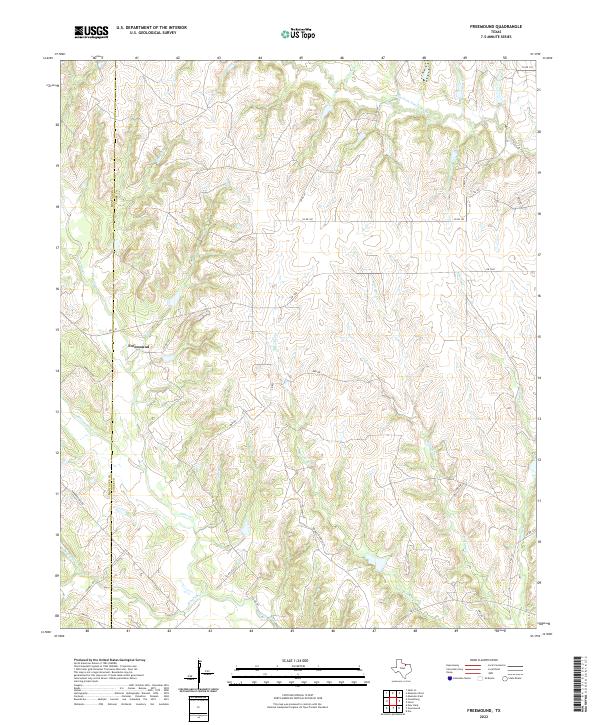
2022 Map of Freemound
USGS Topo · Published 2022About this map
Freemound sits at the heart of this North Texas landscape, a quiet crossroads where Cooke and Montague counties meet. The area is defined by the headwaters of the Elm Fork Trinity River and a dense network of seasonal and perennial streams like Clear Creek, Williams Cr, and Blocker Cr. This terrain is deeply etched with small draws and branches, including Pitman Br and Loring Br, which flow through the dissected uplands characteristic of the region north of the FM 922 corridor.
Find a feature on this map
32 named features on this map. Tap any name to fly to it.
Don’t see what you’re looking for? This feature index may not catch every label — zoom into the map to look around manually.
Map Details
Editions of this 2022 Freemound Map
This is the sole edition of this map. No revisions or reprints were ever made.
Other maps of this area

1902 · Gainesville
USGS Topo · 1:125,000

1905 · Montague
USGS Topo · 1:125,000

1943 · Gainesville
USGS Topo · 1:125,000

1954 · Sherman
USGS Topo · 1:250,000

1958 · Sherman
USGS Topo · 1:250,000

1961 · Muenster West
USGS Topo · 1:24,000

1961 · Saint Jo
USGS Topo · 1:24,000

1961 · Freemound
USGS Topo · 1:24,000

1961 · New Harp
USGS Topo · 1:24,000

1961 · Era
USGS Topo · 1:24,000