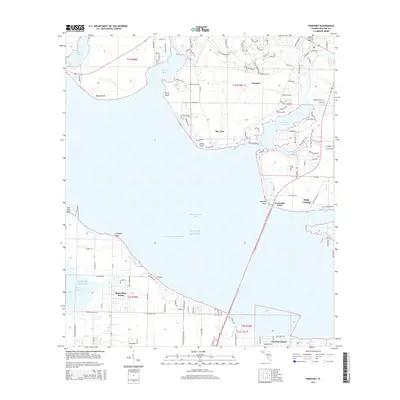
2015 Map of Freeport
USGS Topo · Published 2015About this map
Freeport sits at the northern edge of this coastal landscape, where Lafayette Creek and Fourmile Creek flow into the sheltered waters of LaGrange Bayou. The map illustrates the complex interface of the Choctawhatchee Bay and the Gulf of Mexico, separated by the developed peninsula of Santa Rosa Beach. Transportation through these waters is defined by the Intracoastal Waterway, which cuts across the bay, linking the various inlets and points.
Find a feature on this map
126 named features on this map. Tap any name to fly to it.
Don’t see what you’re looking for? This feature index may not catch every label — zoom into the map to look around manually.
Map Details
Editions of this 2015 Freeport Map
This is the sole edition of this map. No revisions or reprints were ever made.
Other maps of this area

1934 · Niceville
USGS Topo · 1:48,000

1935 · Villa Tasso
USGS Topo · 1:48,000

1935 · De Funiak Springs
USGS Topo · 1:48,000

1936 · Niceville
USGS Topo · 1:62,500

1936 · Point Washington
USGS Topo · 1:48,000

1938 · Villa Tasso
USGS Topo · 1:62,500

1938 · De Funiak Springs
USGS Topo · 1:62,500

1939 · Point Washington
USGS Topo · 1:62,500

1956 · Niceville
USGS Topo · 1:62,500

1956 · Villa Tasso
USGS Topo · 1:62,500