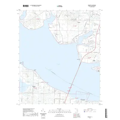
2021 Map of Freeport
USGS Topo · Published 2021About this map
Choctawhatchee Bay dominates this coastal landscape, serving as the central link between the northern settlements and the southern beaches. The town of Freeport is situated at the head of LaGrange Bayou, where Lafayette Creek and Fourmile Cr converge, illustrating a development pattern dictated by access to deep water. Across the bay, Santa Rosa Beach and Choctaw Beach line the southern shore along the Intracoastal Waterway, marking the transition from the protected waters of Hogtown Bayou and Churchill Bayou to the expansive Point Washington State Forest Trl. The map details a network of landings and points, such as Blooms Lndg and Wheeler Point, which historically served as vital maritime nodes. Notable recreational and natural features including the Basin Bayou Camp Site and Nancys Cut Island highlight the region's enduring character as a junction of forest, marsh, and sea.
Find a feature on this map
122 named features on this map. Tap any name to fly to it.
Don’t see what you’re looking for? This feature index may not catch every label — zoom into the map to look around manually.
Map Details
Editions of this 2021 Freeport Map
This is the sole edition of this map. No revisions or reprints were ever made.
Other maps of this area

1934 · Niceville
USGS Topo · 1:48,000

1935 · Villa Tasso
USGS Topo · 1:48,000

1935 · De Funiak Springs
USGS Topo · 1:48,000

1936 · Niceville
USGS Topo · 1:62,500

1936 · Point Washington
USGS Topo · 1:48,000

1938 · Villa Tasso
USGS Topo · 1:62,500

1938 · De Funiak Springs
USGS Topo · 1:62,500

1939 · Point Washington
USGS Topo · 1:62,500

1956 · Niceville
USGS Topo · 1:62,500

1956 · Villa Tasso
USGS Topo · 1:62,500