2024 Map of Freeport
USGS Topo · Published 2024About this map
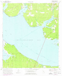
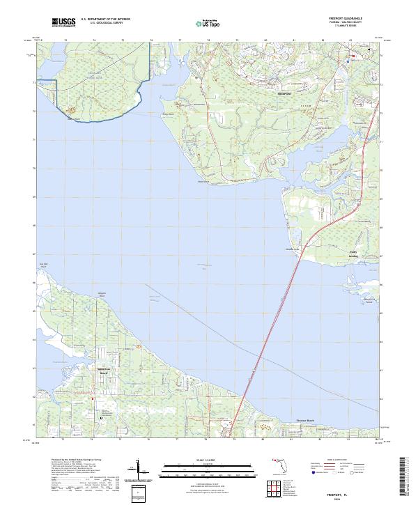
Freeport and the surrounding shoreline of Choctawhatchee Bay define this Walton County landscape, where the terrestrial world meets an intricate network of coastal waters. The map documents the complex geography of LaGrange Bayou, Alaqua Bayou, and Hogtown Bayou, showing how these fingers of water dictate the placement of roads and settlements. To the north, Lafayette Creek and Fourmile Creek feed into the bay system, while the modern transit of the Intracostal Waterway cuts across the open water. Historic local markers such as the Melvin Cem near Freeport and the Christ the King Episcopal Columbarium in Santa Rosa Beach provide touchstones for local genealogy. The northern portion of the map includes a section of Eglin Air Force Base, illustrating the significant military presence that borders civilian areas like Piney Point and Fluffy Landing.
Find a feature on this map
127 named features on this map. Tap any name to fly to it.
Don’t see what you’re looking for? This feature index may not catch every label — zoom into the map to look around manually.
Map Details
Editions of this 2024 Freeport Map
This is the sole edition of this map. No revisions or reprints were ever made.