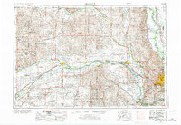
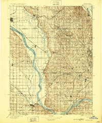
1896 Map of Fremont
USGS Topo · Published 1902About this map
The Platte River and Elkhorn River dominate this late nineteenth-century landscape, carving wide valleys through the Nebraska prairie. As a vital transportation corridor, the region shows the heavy influence of competing rail lines, including the Union Pacific R.R. and the Fremont Elkhorn & Mo. Val. R.R., which facilitated the rapid growth of agricultural shipping hubs. Small riverside settlements like Waterloo and Valley sit at the intersection of river bends and steel rails, while the larger town of Fremont anchors the northwestern corner of the survey. To the east, the topography becomes more broken near the Missouri River, where the hills around Calhoun and Benson rise above the alluvial plains. This survey captures a moment when the grid system of the Great Plains was firmly established, yet the natural drainage of creeks like Big Papillion Creek and Rawhide Creek still dictated the placement of early townships and country roads.
Find a feature on this map
90 named features on this map. Tap any name to fly to it.
Don’t see what you’re looking for? This feature index may not catch every label — zoom into the map to look around manually.
Map Details
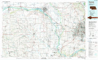
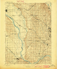
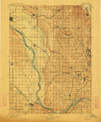
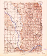
Editions of this 1896 Fremont Map
5 editions found

Historical Maps of Omaha Through Time
6 maps found