Loading...
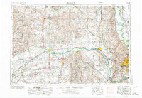
Loading map...1896 Map of Fremont
USGS Topo · Published 1912About this map
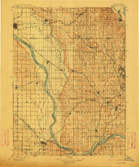
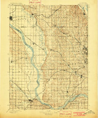
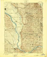
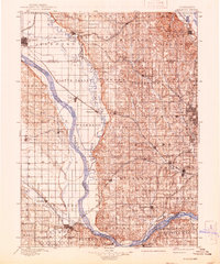
The Platte River and Elkhorn River dominate this late nineteenth-century landscape, carving a wide valley through eastern Nebraska. This area, surveyed by Jno. H. Renshawe and H.S. Wallace, shows a region defined by its critical rail junctions and river crossings. Major transport arteries like the Union Pacific R. R. and the Burlington and Missouri River R. R. intersect the terrain, connecting established settlements like Fremont and Ashland to burgeoning peripheral towns such as Gretna, Millard, and Waterloo.
Find a feature on this map
82 named features on this map. Tap any name to fly to it.
Don’t see what you’re looking for? This feature index may not catch every label — zoom into the map to look around manually.
Map Details
Date Portrayed1896
Date Published1912
PublisherU.S. Geological Survey
Map TypeTopographic
Scale1:125,000
Physical Dimensions16.3 x 19.7 inches
Editions of this 1896 Fremont Map
5 editions found

Historical Maps of Omaha Through Time
6 maps found


Featured Locations
Source Details
SourceU.S. Geological Survey
CopyrightPublic Domain