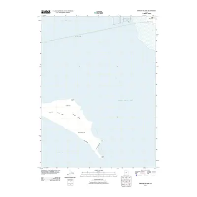
2011 Map of Fremont Island
USGS Topo · Published 2011About this map
Fremont Island dominates this section of the Great Salt Lake, revealing a landscape shaped by changing water levels and unique island topography. The island is punctuated by notable high points such as Beacon Hill, Castle Rock, and David E Miller Hill, while its perimeter features Jones Beach and the long Fremont Island Bar extending toward the southeast. The survey highlights the island's isolation from the mainland, though the distant Bear River Bridge provides a modern link across the northern reaches of the bay.
Find a feature on this map
18 named features on this map. Tap any name to fly to it.
Don’t see what you’re looking for? This feature index may not catch every label — zoom into the map to look around manually.
Map Details
Editions of this 2011 Fremont Island Map
This is the sole edition of this map. No revisions or reprints were ever made.
Other maps of this area

1954 · Antelope Island North
USGS Topo · 1:24,000

1954 · Brigham City
USGS Topo · 1:250,000

1955 · Willard Spur
USGS Topo · 1:24,000

1955 · Plain City SW
USGS Topo · 1:24,000

1955 · Ogden Bay
USGS Topo · 1:24,000

1955 · Fremont Island
USGS Topo · 1:24,000

1958 · Brigham City
USGS Topo · 1:250,000

1962 · Brigham City
USGS Topo · 1:250,000

1968 · Pokes Point
USGS Topo · 1:24,000

1968 · Promontory Point
USGS Topo · 1:24,000