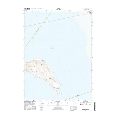
2017 Map of Fremont Island
USGS Topo · Published 2017About this map
Fremont Island dominates the center of this survey, surrounded by the waters of the Great Salt Lake. This topographical study reveals the island's complex interior, from the heights of David E Miller Hill and Beacon Hill down to the sheltered Circle Valley. The shoreline is marked by distinct features such as Jones Beach and Argo Point, while the narrow Fremont Island Bar extends toward the south.
Find a feature on this map
21 named features on this map. Tap any name to fly to it.
Don’t see what you’re looking for? This feature index may not catch every label — zoom into the map to look around manually.
Map Details
Editions of this 2017 Fremont Island Map
This is the sole edition of this map. No revisions or reprints were ever made.
Other maps of this area

1954 · Antelope Island North
USGS Topo · 1:24,000

1954 · Brigham City
USGS Topo · 1:250,000

1955 · Willard Spur
USGS Topo · 1:24,000

1955 · Plain City SW
USGS Topo · 1:24,000

1955 · Ogden Bay
USGS Topo · 1:24,000

1955 · Fremont Island
USGS Topo · 1:24,000

1958 · Brigham City
USGS Topo · 1:250,000

1962 · Brigham City
USGS Topo · 1:250,000

1968 · Pokes Point
USGS Topo · 1:24,000

1968 · Promontory Point
USGS Topo · 1:24,000