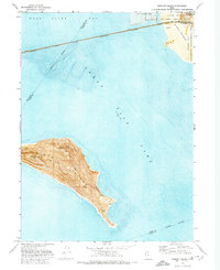
1972 Map of Fremont Island
USGS Topo · Published 1974About this map
Fremont Island rises as a prominent landmass within the Great Salt Lake, offering a detailed view of its topography and shoreline in the early 1970s. The map illustrates the island's interior features, such as Beacon Hill, Castle Rock, and Circle Valley, while also noting traces of human presence like a Corral, Ruins, and unidentified Graves near the southern tip.
Find a feature on this map
18 named features on this map. Tap any name to fly to it.
Don’t see what you’re looking for? This feature index may not catch every label — zoom into the map to look around manually.
Map Details
Editions of this 1972 Fremont Island Map
This is the sole edition of this map. No revisions or reprints were ever made.
Other maps of this area

1954 · Antelope Island North
USGS Topo · 1:24,000

1954 · Brigham City
USGS Topo · 1:250,000

1955 · Willard Spur
USGS Topo · 1:24,000

1955 · Plain City SW
USGS Topo · 1:24,000

1955 · Ogden Bay
USGS Topo · 1:24,000

1955 · Fremont Island
USGS Topo · 1:24,000

1958 · Brigham City
USGS Topo · 1:250,000

1962 · Brigham City
USGS Topo · 1:250,000

1968 · Pokes Point
USGS Topo · 1:24,000

1968 · Promontory Point
USGS Topo · 1:24,000