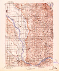
1982 Map of Fremont
USGS Topo · Published 1982About this map
The Platte River and Elkhorn River dominate this eastern Nebraska landscape, shaping a corridor defined by fertile bottomlands and complex water management systems like the North Bend Canal. In the early 1980s, the region shows a dense network of major railroads including the Union Pacific and Burlington Northern, which link established agricultural centers like Fremont and Wahoo to the western edge of Omaha. This survey captures a moment when large-scale institutional and military footprints were prominent, from the University of Nebraska Field Laboratory to the Nebraska National Guard Training Area and Camp Ashland. The map also illustrates the development of local recreation and conservation, featuring the De Soto National Wildlife Refuge and Two Rivers State Recreation Area along the river bends.
Find a feature on this map
119 named features on this map. Tap any name to fly to it.
Don’t see what you’re looking for? This feature index may not catch every label — zoom into the map to look around manually.
Map Details
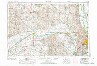
Editions of this 1982 Fremont Map
2 editions found
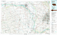
Historical Maps of Omaha Through Time
6 maps found