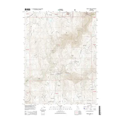
2015 Map of French Corral
USGS Topo · Published 2015About this map
San Juan Ridge forms the backbone of this landscape where the Middle Yuba River and South Yuba River converge. The settlement of French Corral serves as a historic anchor for the region, positioned near the famous Bridgeport Covered Bridge at Bridgeport. This area reflects the deep history of Gold Country mining and hydraulic activity, evident in the numerous river bars and ravines that segment the terrain, such as Condemned Bar, French Bar, and Starvation Bar.
Find a feature on this map
67 named features on this map. Tap any name to fly to it.
Don’t see what you’re looking for? This feature index may not catch every label — zoom into the map to look around manually.
Map Details
Editions of this 2015 French Corral Map
This is the sole edition of this map. No revisions or reprints were ever made.
Other maps of this area

1888 · Smartsville
USGS Topo · 1:125,000

1891 · Smartsville
USGS Topo · 1:125,000

1892 · Smartsville
USGS Topo · 1:125,000

1894 · Smartsville
USGS Topo · 1:125,000

1895 · Smartsville
USGS Topo · 1:125,000

1941 · Bangor
USGS Topo · 1:62,500

1944 · Bangor
USGS Topo · 1:62,500

1948 · Nevada City
USGS Topo · 1:62,500
1948 · Oregon House
USGS Topo · 1:24,000
1948 · Camptonville
USGS Topo · 1:24,000