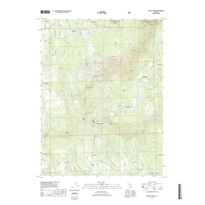
2018 Map of French Corral
USGS Topo · Published 2018About this map
French Corral and the surrounding gold country of Nevada County are defined by the convergence of the North Yuba River and South Yuba River. This 2018 survey reveals a landscape where hydraulic mining legacy meets modern recreation, anchored by the Bridgeport Covered Bridge at the river's edge. The high ground of San Juan Ridge separates the drainage basins, dotted with small communities like Birchville and Dobbins. The presence of the Colgate Tunnel and several named bars, including French Bar and Condemned Bar, alludes to the extensive water management and mining history of the region. Local connectivity is maintained through a network of winding routes such as Pleasant Valley Road and Bitney Springs Road, while recreational corridors like the Buttermilk Bend Trail and Point Defiance Loop Trail provide access to the steep canyon slopes.
Find a feature on this map
110 named features on this map. Tap any name to fly to it.
Don’t see what you’re looking for? This feature index may not catch every label — zoom into the map to look around manually.
Map Details
Editions of this 2018 French Corral Map
This is the sole edition of this map. No revisions or reprints were ever made.
Other maps of this area

1888 · Smartsville
USGS Topo · 1:125,000

1891 · Smartsville
USGS Topo · 1:125,000

1892 · Smartsville
USGS Topo · 1:125,000

1894 · Smartsville
USGS Topo · 1:125,000

1895 · Smartsville
USGS Topo · 1:125,000

1941 · Bangor
USGS Topo · 1:62,500

1944 · Bangor
USGS Topo · 1:62,500

1948 · Nevada City
USGS Topo · 1:62,500
1948 · Oregon House
USGS Topo · 1:24,000
1948 · Camptonville
USGS Topo · 1:24,000