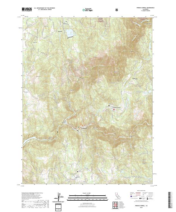
2022 Map of French Corral
USGS Topo · Published 2022About this map
San Juan Ridge serves as the central spine of this landscape, dividing the watersheds where the Yuba River and its branches have carved deep into the California foothills. The settlement of French Corral sits prominently along this ridge, established near the French Corral Cem and the winding course of French Corral Cr. To the south, the village of Bridgeport marks a crossing point near Buttermilk Bend, where the S Yuba River meets the historical site of Kneebone Cem. The northern reach of the survey is dominated by the community of Dobbins, positioned near Lake Francis and the Dobbins Sacred Heart Catholic Cem. This area’s 19th-century gold mining legacy is written into the terrain labels, from the river bars at Condemned Bar and Starvation Bar to the named peaks of Scott Hill, Texas Hill, and Dixon Hill.
Find a feature on this map
78 named features on this map. Tap any name to fly to it.
Don’t see what you’re looking for? This feature index may not catch every label — zoom into the map to look around manually.
Map Details
Editions of this 2022 French Corral Map
This is the sole edition of this map. No revisions or reprints were ever made.
Other maps of this area

1888 · Smartsville
USGS Topo · 1:125,000

1891 · Smartsville
USGS Topo · 1:125,000

1892 · Smartsville
USGS Topo · 1:125,000

1894 · Smartsville
USGS Topo · 1:125,000

1895 · Smartsville
USGS Topo · 1:125,000

1941 · Bangor
USGS Topo · 1:62,500

1944 · Bangor
USGS Topo · 1:62,500

1948 · Nevada City
USGS Topo · 1:62,500
1948 · Oregon House
USGS Topo · 1:24,000
1948 · Camptonville
USGS Topo · 1:24,000