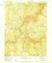
1950 Map of French Corral
USGS Topo · Published 1950About this map
San Juan Ridge dominates this Sierra Nevada foothills landscape, where Gold Rush history intersects with mid-century hydroelectric development. The Yuba River and its branches carve deep through the terrain, featuring the then-active Colgate Powerhouse and the waters of Englebright Reservoir. Cultural history is anchored by the settlement at French Corral and nearby Birchville, while the presence of the San Juan Mine (Inactive) points to the area's extraction roots.
Find a feature on this map
48 named features on this map. Tap any name to fly to it.
Don’t see what you’re looking for? This feature index may not catch every label — zoom into the map to look around manually.
Map Details
Editions of this 1950 French Corral Map
This is the sole edition of this map. No revisions or reprints were ever made.
Other maps of this area

1888 · Smartsville
USGS Topo · 1:125,000

1891 · Smartsville
USGS Topo · 1:125,000

1892 · Smartsville
USGS Topo · 1:125,000

1894 · Smartsville
USGS Topo · 1:125,000

1895 · Smartsville
USGS Topo · 1:125,000

1941 · Bangor
USGS Topo · 1:62,500

1944 · Bangor
USGS Topo · 1:62,500

1948 · Nevada City
USGS Topo · 1:62,500
1948 · Oregon House
USGS Topo · 1:24,000
1948 · Camptonville
USGS Topo · 1:24,000