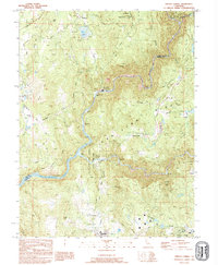
1995 Map of French Corral
USGS Topo · Published 1995About this map
The San Juan Ridge dominates this 1990s topographic view of the California gold country, where the legacy of hydraulic mining remains etched into the landscape. Extensive tailings and sprawling excavation areas such as the French Corral Diggings and Birchville Diggings show the massive scale of 19th-century operations. The Yuba River flows through the center of the quadrangle, flanked by the South Yuba River State Park Unit and the historic community of Bridgeport, notable for its Historical Covered Bridge. Modern industrial footprints appear alongside these historical sites, including the New Colgate Powerhouse and the waters of Harry L Englebright Lake. To the south, Pleasant Valley retains its rural character with the Pleasant Valley Sch and several small cemeteries serving the local area.
Find a feature on this map
53 named features on this map. Tap any name to fly to it.
Don’t see what you’re looking for? This feature index may not catch every label — zoom into the map to look around manually.
Map Details
Editions of this 1995 French Corral Map
This is the sole edition of this map. No revisions or reprints were ever made.
Other maps of this area

1888 · Smartsville
USGS Topo · 1:125,000

1891 · Smartsville
USGS Topo · 1:125,000

1892 · Smartsville
USGS Topo · 1:125,000

1894 · Smartsville
USGS Topo · 1:125,000

1895 · Smartsville
USGS Topo · 1:125,000

1941 · Bangor
USGS Topo · 1:62,500

1944 · Bangor
USGS Topo · 1:62,500

1948 · Nevada City
USGS Topo · 1:62,500
1948 · Oregon House
USGS Topo · 1:24,000
1948 · Camptonville
USGS Topo · 1:24,000