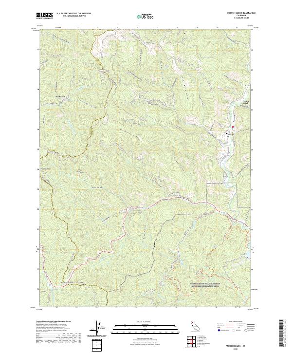
2022 Map of French Gulch
USGS Topo · Published 2022About this map
French Gulch serves as the focal point of this terrain, where the settlement is surrounded by a dense network of gulches and ridges that speak to its mining-era heritage. The landscape is defined by its water-moving infrastructure, including the Crystal Creek Water Ditch Trl and Camden Water Ditch Trl, reflecting the historical importance of hydraulic management in this part of California. Along the eastern edge, French Gulch Cem provides a point of interest for genealogists, while the settlement of Deadwood remains marked along Deadwood Cr to the northwest.
Find a feature on this map
74 named features on this map. Tap any name to fly to it.
Don’t see what you’re looking for? This feature index may not catch every label — zoom into the map to look around manually.
Map Details
Editions of this 2022 French Gulch Map
This is the sole edition of this map. No revisions or reprints were ever made.
Other maps of this area

1890 · Red Bluff
USGS Topo · 1:250,000

1894 · Red Bluff
USGS Topo · 1:250,000

1913 · Weaverville
USGS Topo · 1:125,000

1944 · French Gulch
USGS Topo · 1:62,500

1948 · French Gulch
USGS Topo · 1:62,500

1950 · Minersville
USGS Topo · 1:62,500

1950 · Schell Mtn
USGS Topo · 1:62,500

1950 · Weaverville
USGS Topo · 1:62,500
1952 · Schell Mtn.
USGS Topo · 1:62,500

1952 · Weaverville
USGS Topo · 1:62,500