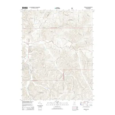
2014 Map of French Lick
USGS Topo · Published 2014About this map
Hoosier National Forest dominates the landscape of this southern Indiana region, where the terrain is defined by a dense network of winding creeks and the significant path of the Lost River. The western edge of the map features the developed infrastructure around the town, including Abbeydell Pike, W Beechwood Ave, and W College St, contrasting with the deep woodland of the forest to the south and east. The hydrology is particularly intricate here; water bodies like Lick Cr and Upper Sulphur Cr carve through the hills, illustrating the drainage patterns that have shaped the local topography. This 2014 survey documents the convergence of modern transportation routes like Us-150 and In-56 with the older, more isolated country roads such as Gorge Rd and W Co Road 400 N that reach into the forest interior.
Find a feature on this map
39 named features on this map. Tap any name to fly to it.
Don’t see what you’re looking for? This feature index may not catch every label — zoom into the map to look around manually.
Map Details
Editions of this 2014 French Lick Map
This is the sole edition of this map. No revisions or reprints were ever made.
Other maps of this area

1948 · Huron
USGS Topo · 1:24,000

1949 · Georgia
USGS Topo · 1:24,000

1950 · Mitchell
USGS Topo · 1:24,000

1950 · Huron
USGS Topo · 1:24,000

1950 · Valeene
USGS Topo · 1:24,000

1951 · Hillham
USGS Topo · 1:24,000

1951 · French Lick
USGS Topo · 1:24,000

1951 · Georgia
USGS Topo · 1:24,000

1956 · Greenbrier
USGS Topo · 1:24,000

1956 · Vincennes
USGS Topo · 1:250,000