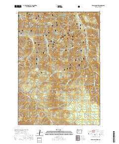
2020 Map of French Mountain
USGS Topo · Published 2020About this map
Willamette National Forest encompasses this high-elevation landscape in the Cascade Range, where a network of drainages like French Pete Cr and Horse Cr carve through prominent peaks. The topography is defined by significant summits such as French Mtn, Olallie Mtn, and Horsepasture Mtn. High-country meadows and specialized wetland features are scattered throughout the terrain, including the Quaking Aspen Swamp, Pothole Meadow, and Olallie Meadows. These features suggest a landscape managed for natural resource preservation and seasonal access, punctuated by distinct geological formations like Taylor Castle and The Potholes. Small alpine water bodies, specifically Karl Lake and Ruth Lake, sit near Lowder Mtn, highlighting the glaciated character of this portion of the Oregon wilderness.
Find a feature on this map
53 named features on this map. Tap any name to fly to it.
Don’t see what you’re looking for? This feature index may not catch every label — zoom into the map to look around manually.
Map Details
Editions of this 2020 French Mountain Map
This is the sole edition of this map. No revisions or reprints were ever made.
Other maps of this area

1925 · Waldo Lake
USGS Topo · 1:125,000

1929 · Three Sisters
USGS Topo · 1:125,000

1930 · Maiden Peak
USGS Topo · 1:125,000

1932 · Three Sisters
USGS Topo · 1:125,000

1934 · Maiden Peak
USGS Topo · 1:125,000

1934 · Mc Kenzie Bridge
USGS Topo · 1:96,000

1940 · Mc Kenzie Bridge
USGS Topo · 1:125,000

1953 · Salem
USGS Topo · 1:250,000

1954 · Salem
USGS Topo · 1:250,000

1955 · Chucksney Mtn
USGS Topo · 1:62,500