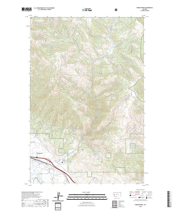
2024 Map of Frenchtown
USGS Topo · Published 2024About this map
Frenchtown sits at the base of the Reservation Divide in Missoula County, where the developed valley floor meets the rising timber of the Lolo National Forest. This modern record of the area shows a landscape defined by water management and mountain drainage, notably through the Frenchtown Irrigation District Ditch and the winding course of Mill Creek. The settlement pattern follows the historic corridor of Old Hwy 10 W and Mullan Rd, reflecting the community's growth along the old military and transit routes. Local history is anchored by the Saint John the Baptist Catholic Cem, while the northern portion of the map is dominated by steep drainage basins such as Lion Gulch, Cottonwood Gulch, and Blind Gulch, eventually leading to the high point at Charity Peak.
Find a feature on this map
39 named features on this map. Tap any name to fly to it.
Don’t see what you’re looking for? This feature index may not catch every label — zoom into the map to look around manually.
Map Details
Editions of this 2024 Frenchtown Map
This is the sole edition of this map. No revisions or reprints were ever made.
Other maps of this area

1912 · Missoula
USGS Topo · 1:125,000

1956 · Wallace
USGS Topo · 1:250,000

1956 · Hamilton
USGS Topo · 1:250,000

1959 · Hamilton
USGS Topo · 1:250,000

1959 · Alberton
USGS Topo · 1:62,500

1959 · Arlee
USGS Topo · 1:62,500

1960 · Wallace
USGS Topo · 1:250,000

1960 · Hamilton
USGS Topo · 1:250,000

1963 · Primrose
USGS Topo · 1:24,000

1964 · Hamilton
USGS Topo · 1:250,000