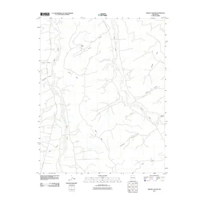
2010 Map of Fresno Canyon
USGS Topo · Published 2010About this map
Blanco Wash and Cañon Largo define the drainage patterns of this high desert terrain in San Juan County. The landscape is characterized by a complex network of dry washes and deep canyons that cut through high-elevation features like Blanco Mesa and Encinada Mesa. These geological formations, including Huerfanito Canyon and Smith Canyon, indicate an environment where seasonal water flow has historically shaped the travel corridors and ranching potential of the area. A solitary arterial road, County RD 7007, provides the primary modern access across the western canyons. Local landmarks such as Hollis Pass and Fresno Canyon highlight the topographical challenges faced by early residents and surveyors moving between the mesa tops and the canyon floors.
Find a feature on this map
15 named features on this map. Tap any name to fly to it.
Don’t see what you’re looking for? This feature index may not catch every label — zoom into the map to look around manually.
Map Details
Editions of this 2010 Fresno Canyon Map
This is the sole edition of this map. No revisions or reprints were ever made.
Other maps of this area

1889 · Largo
USGS Topo · 1:250,000

1895 · Largo
USGS Topo · 1:250,000

1954 · Aztec
USGS Topo · 1:250,000

1958 · Aztec
USGS Topo · 1:250,000

1959 · Gould Pass
USGS Topo · 1:62,500

1959 · Nageezi
USGS Topo · 1:62,500

1960 · Bloomfield
USGS Topo · 1:62,500

1962 · Aztec
USGS Topo · 1:250,000

1965 · Aztec
USGS Topo · 1:250,000
1967 · Huerfano Trading Post
USGS Topo · 1:24,000