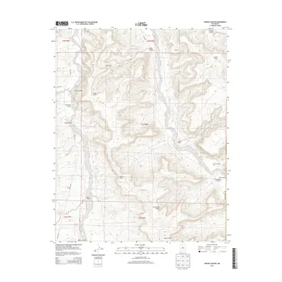
2013 Map of Fresno Canyon
USGS Topo · Published 2013About this map
San Juan Basin Gas Field infrastructure dots the high desert landscape of San Juan County in this 2013 survey. The terrain is defined by a complex network of dry washes and deep incisions, most notably Cañon Largo and the expansive Blanco Canyon. The drainage pattern is anchored by the Blanco Wash, which cuts through the southwestern corner of the sheet. Modern access is facilitated by graded paths such as Co Road 7007 and Carrizo Rd, reflecting the region's continued importance for resource extraction.
Find a feature on this map
26 named features on this map. Tap any name to fly to it.
Don’t see what you’re looking for? This feature index may not catch every label — zoom into the map to look around manually.
Map Details
Editions of this 2013 Fresno Canyon Map
This is the sole edition of this map. No revisions or reprints were ever made.
Other maps of this area

1889 · Largo
USGS Topo · 1:250,000

1895 · Largo
USGS Topo · 1:250,000

1954 · Aztec
USGS Topo · 1:250,000

1958 · Aztec
USGS Topo · 1:250,000

1959 · Gould Pass
USGS Topo · 1:62,500

1959 · Nageezi
USGS Topo · 1:62,500

1960 · Bloomfield
USGS Topo · 1:62,500

1962 · Aztec
USGS Topo · 1:250,000

1965 · Aztec
USGS Topo · 1:250,000
1967 · Huerfano Trading Post
USGS Topo · 1:24,000