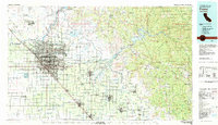
1982 Map of Fresno
USGS Topo · Published 1983About this map
The agricultural heart of the San Joaquin Valley is anchored by Fresno and its expanding suburbs in the early 1980s. This survey illustrates the intricate irrigation network essential to the region's viticulture and orchards, featuring the Friant-Kern Canal and Madera Canal which draw from the San Joaquin River. The map captures the urban density of Clovis and Fig Garden contrasting with the rural industrial character of Raisin City and Malaga.
Find a feature on this map
144 named features on this map. Tap any name to fly to it.
Don’t see what you’re looking for? This feature index may not catch every label — zoom into the map to look around manually.
Map Details
Editions of this 1982 Fresno Map
2 editions found
Other maps of this area

1903 · Tehipite
USGS Topo · 1:125,000

1904 · Kaiser
USGS Topo · 1:125,000

1904 · Kaweah
USGS Topo · 1:125,000

1905 · Tehipite
USGS Topo · 1:125,000

1909 · Kaweah
USGS Topo · 1:125,000

1912 · Coalinga
USGS Topo · 1:125,000

1912 · Mariposa
USGS Topo · 1:125,000

1912 · Mt. Goddard
USGS Topo · 1:125,000

1916 · Sulphur Springs
USGS Topo · 1:24,000

1919 · Sulphur Springs
USGS Topo · 1:31,680