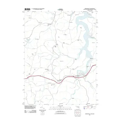
2011 Map of Friendsville
USGS Topo · Published 2011About this map
The Youghiogheny River carves a deep valley through this borderland region where Maryland, Pennsylvania, and West Virginia meet. The borough of Friendsville serves as the primary hub, situated at a bend in the river near Gravel Hill. To the south, the settlement of Kendall marks a more isolated reach of the waterway, while the plateau to the west is dotted with smaller communities such as Asher Glade, Blooming Rose, and Sand Spring.
Find a feature on this map
112 named features on this map. Tap any name to fly to it.
Don’t see what you’re looking for? This feature index may not catch every label — zoom into the map to look around manually.
Map Details
Editions of this 2011 Friendsville Map
This is the sole edition of this map. No revisions or reprints were ever made.
Other maps of this area

1900 · Accident
USGS Topo · 1:62,500

1900 · Uniontown
USGS Topo · 1:62,500

1904 · Bruceton
USGS Topo · 1:62,500

1922 · Confluence
USGS Topo · 1:62,500

1926 · Bruceton
USGS Topo · 1:62,500

1931 · Uniontown
USGS Topo · 1:62,500

1931 · Confluence
USGS Topo · 1:62,500

1931 · Bruceton Mills
USGS Topo · 1:62,500

1933 · Confluence
USGS Topo · 1:62,500

1933 · Bruceton
USGS Topo · 1:62,500