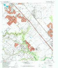
1982 Map of Friendswood
USGS Topo · Published 1983About this map
Ellington Air Force Base dominates the northeastern landscape of this region, serving as a massive military and aviation anchor just north of Clear Lake City. The area's mid-century economic character is defined by the expansive Friendswood Oil Field, where numerous oil wells and pipelines crisscross the terrain between Houston and Friendswood. Suburban development is seen pushing outward in the early 1980s, with residential clusters like Wedgewood Village and Forest Bend established along the winding path of Clear Creek. Significant local infrastructure is evident at the Almeda Mall Shopping Center and educational hubs such as Dobie High School. The map also preserves the location of older landmarks including Whitcomb Cemetery and Hastings, alongside the Atchison Topeka and Santa Fe RR corridor that historically linked these communities.
Find a feature on this map
70 named features on this map. Tap any name to fly to it.
Don’t see what you’re looking for? This feature index may not catch every label — zoom into the map to look around manually.
Map Details
Editions of this 1982 Friendswood Map
2 editions found
Other maps of this area

1915 · Park Place
USGS Topo · 1:24,000

1915 · Deepwater
USGS Topo · 1:24,000

1916 · Genoa
USGS Topo · 1:24,000

1916 · Seabrook
USGS Topo · 1:24,000

1916 · La Porte
USGS Topo · 1:24,000

1919 · Deepwater
USGS Topo · 1:31,680

1920 · Seabrook
USGS Topo · 1:31,680

1920 · Genoa
USGS Topo · 1:31,680

1920 · Mykawa
USGS Topo · 1:31,680

1920 · La Porte
USGS Topo · 1:31,680