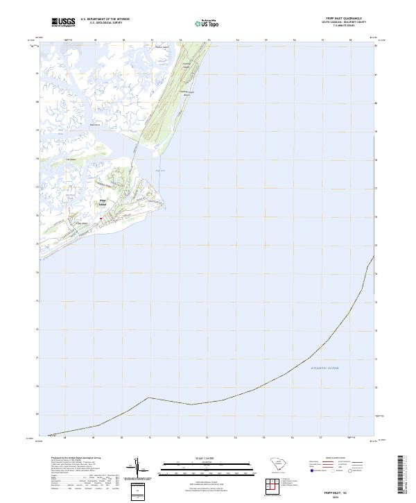
2024 Map of Fripp Inlet
USGS Topo · Published 2024About this map
Fripp Island and the adjacent barrier island chain appear here as a complex network of coastal residential development and protected natural space. The map illustrates the contrast between the highly developed streets of Fripp Island, featuring a dense web of residential roads like Tarpon Blvd, Marlin Dr, and Dolphin Rd, and the preserved landscape of Hunting Island to the north. These landmasses are separated by the dynamic Fripp Inlet, where tidal forces shape the surrounding marshes and points.
Find a feature on this map
31 named features on this map. Tap any name to fly to it.
Don’t see what you’re looking for? This feature index may not catch every label — zoom into the map to look around manually.
Map Details
Editions of this 2024 Fripp Inlet Map
This is the sole edition of this map. No revisions or reprints were ever made.
Other maps of this area

1920 · St. Helena Sound
USGS Topo · 1:62,500

1920 · Hilton Head
USGS Topo · 1:62,500

1944 · Fort Fremont
USGS Topo · 1:62,500

1945 · Hilton Head
USGS Topo · 1:62,500

1947 · Savannah
USGS Topo · 1:250,000

1948 · St. Helena Sound
USGS Topo · 1:62,500

1948 · Savannah
USGS Topo · 1:250,000

1956 · Frogmore
USGS Topo · 1:24,000
1956 · Edisto Beach
USGS Topo · 1:24,000
1956 · St. Helena Sound
USGS Topo · 1:24,000