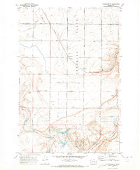
1970 Map of Frischknecht
USGS Topo · Published 1973About this map
Paradise Flats defines this agricultural landscape in eastern Washington, where the boundary of Adams County and Franklin County intersects a grid of gravel roads and industrial infrastructure. The region's dependence on rail and grain storage is evident through the Burlington Northern line and clusters of Grain Elevators at Frischknecht and Schlomer. The topography is marked by significant geologic depressions including Providence Coulee and the wide Esquatzel Coulee to the south.
Find a feature on this map
41 named features on this map. Tap any name to fly to it.
Don’t see what you’re looking for? This feature index may not catch every label — zoom into the map to look around manually.
Map Details
Editions of this 1970 Frischknecht Map
This is the sole edition of this map. No revisions or reprints were ever made.
Other maps of this area

1916 · Connell
USGS Topo · 1:125,000

1918 · Connell
USGS Topo · 1:125,000

1924 · Othello
USGS Topo · 1:62,500

1925 · Scooteney Lake
USGS Topo · 1:62,500

1951 · Scooteney Lake
USGS Topo · 1:62,500

1953 · Walla Walla
USGS Topo · 1:250,000

1954 · Bruce
USGS Topo · 1:24,000

1954 · Othello
USGS Topo · 1:62,500

1958 · Walla Walla
USGS Topo · 1:250,000

1965 · Mesa
USGS Topo · 1:62,500