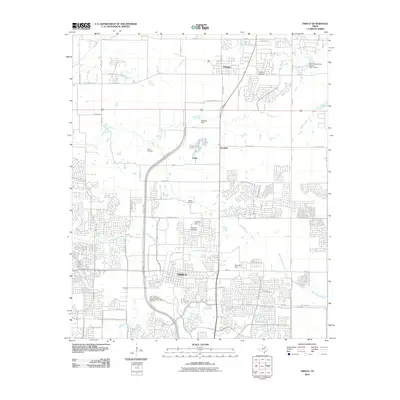
2010 Map of Frisco
USGS Topo · Published 2010About this map
Frisco and Prosper anchor this 2010 topographic record of northern Texas, a landscape in the midst of significant suburban transformation. While dense street grids expand across the southern half of the quadrangle, the northern sections retain a more traditional rural character defined by numbered county roads and water management features like the Caldwell Dam and Vial Lake Dam. Genealogists and local historians can find several established burial grounds, including Smith Cemetery, Bethel Cemetery, and Anderson Cemetery, which remain as quiet landmarks amidst the growing infrastructure. The area is dissected by numerous waterways, such as Panther Creek and White Rock Creek, whose drainage patterns continue to shape the layout of new residential developments and public works, like the City of Frisco Water Treatment Facility. Smaller aviation history is noted by the presence of Drewery Airport near the northeastern edge of Prosper.
Find a feature on this map
68 named features on this map. Tap any name to fly to it.
Don’t see what you’re looking for? This feature index may not catch every label — zoom into the map to look around manually.
Map Details
Editions of this 2010 Frisco Map
This is the sole edition of this map. No revisions or reprints were ever made.
Other maps of this area

1925 · Mc Kinney 3-c
USGS Topo · 1:48,000

1929 · Frisco
USGS Topo · 1:62,500

1929 · McKinney
USGS Topo · 1:62,500

1954 · Sherman
USGS Topo · 1:250,000

1958 · Sherman
USGS Topo · 1:250,000

1960 · Frisco
USGS Topo · 1:24,000

1960 · Celina
USGS Topo · 1:24,000

1960 · Plano
USGS Topo · 1:24,000

1960 · Aubrey
USGS Topo · 1:24,000
1960 · Lewisville East
USGS Topo · 1:24,000