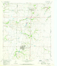
1969 Map of Frisco
USGS Topo · Published 1969About this map
Prosper and Frisco are the primary hubs on this North Texas prairie landscape, situated along the corridor of the St Louis San Francisco railroad. The map captures a moment of early suburban transition as the Dallas area expanded northward, though much of the land remains divided by the fine fence and field lines of family farms. Rural life is anchored by locations like Good Hope Ch and several small burial grounds, including Landrum Cem and Smith Cem. Significant natural drainage features such as Panther Creek and Cottonwood Branch wind through the terrain, while industrial activity is visible at several Gravel Pits and a Quarry. The intersection of Rockhill Road and the railroad near Rockhill provides a look at the infrastructure that preceded the rapid development of the late twentieth century.
Find a feature on this map
24 named features on this map. Tap any name to fly to it.
Don’t see what you’re looking for? This feature index may not catch every label — zoom into the map to look around manually.
Map Details
Editions of this 1969 Frisco Map
This is the sole edition of this map. No revisions or reprints were ever made.
Other maps of this area

1925 · Mc Kinney 3-c
USGS Topo · 1:48,000

1929 · Frisco
USGS Topo · 1:62,500

1929 · McKinney
USGS Topo · 1:62,500

1954 · Sherman
USGS Topo · 1:250,000

1958 · Sherman
USGS Topo · 1:250,000

1960 · Frisco
USGS Topo · 1:24,000

1960 · Celina
USGS Topo · 1:24,000

1960 · Plano
USGS Topo · 1:24,000

1960 · Aubrey
USGS Topo · 1:24,000
1960 · Lewisville East
USGS Topo · 1:24,000