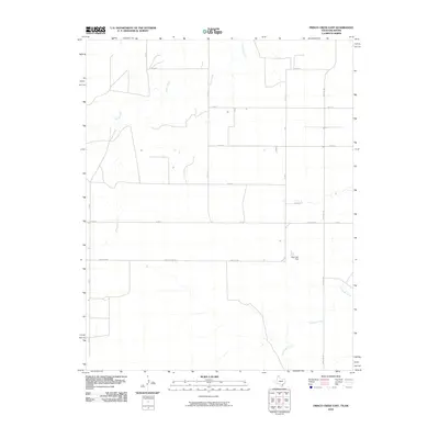
2010 Map of Frisco Creek East
USGS Topo · Published 2010About this map
Frisco Creek and Coldwater Creek meander across this section of the High Plains, carving subtle drainages into an otherwise orderly grid of rural transport. The landscape is defined by its vast agricultural layout, where Co Rd 4 and Co Rd 6 serve as primary north-south arteries connecting the scattered homesteads of Texas County. A notable point of water management in this arid environment is the Steji Lake Dam, which holds back seasonal flow in an area where water is a vital resource. The presence of Farm Rd 1262 and Farm Rd 2349 highlights the infrastructure established to support the region's ranching and farming economy during the early 21st century. This survey provides a clear look at the intersection of natural creek beds and the rigid township and range road system.
Find a feature on this map
15 named features on this map. Tap any name to fly to it.
Don’t see what you’re looking for? This feature index may not catch every label — zoom into the map to look around manually.
Map Details
Editions of this 2010 Frisco Creek East Map
This is the sole edition of this map. No revisions or reprints were ever made.
Other maps of this area

1954 · Perryton
USGS Topo · 1:250,000

1958 · Perryton
USGS Topo · 1:250,000

1968 · Guymon SW
USGS Topo · 1:24,000

1973 · Goodwell SE
USGS Topo · 1:24,000

1973 · Goodwell
USGS Topo · 1:24,000

1973 · Gruver
USGS Topo · 1:24,000

1974 · Sunray 1 NW
USGS Topo · 1:24,000

1974 · Sunray 1 SW
USGS Topo · 1:24,000

1974 · Sunray 1 SE
USGS Topo · 1:24,000

1974 · Sunray 1 NE
USGS Topo · 1:24,000