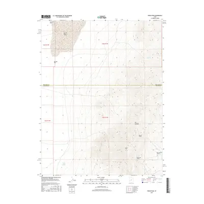
2017 Map of Frisco Peak
USGS Topo · Published 2017About this map
Frisco Peak stands as the high point of this high-desert landscape, anchoring the San Francisco Mountains in the eastern portion of the map. The terrain is defined by dramatic elevation changes where mountain slopes descend into the Wah Wah Valley, culminating in the Wah Wah Valley Hardpan. This arid basin transition is punctuated by essential water sources for ranching and wildlife, including Pitchforth Spring and Crystal Spring.
Find a feature on this map
20 named features on this map. Tap any name to fly to it.
Don’t see what you’re looking for? This feature index may not catch every label — zoom into the map to look around manually.
Map Details
Editions of this 2017 Frisco Peak Map
This is the sole edition of this map. No revisions or reprints were ever made.
Other maps of this area

1953 · Richfield
USGS Topo · 1:250,000

1958 · Richfield
USGS Topo · 1:250,000

1958 · Milford
USGS Topo · 1:62,500

1959 · Frisco
USGS Topo · 1:62,500

1960 · Frisco Peak
USGS Topo · 1:62,500

1960 · Beaver Lake Mts.
USGS Topo · 1:62,500

1980 · Wah Wah Mts. South
USGS Topo · 1:100,000

1980 · Wah Wah Mts. North
USGS Topo · 1:100,000
1989 · High Rock
USGS Topo · 1:24,000
1989 · Frisco Peak
USGS Topo · 1:24,000