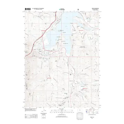
2013 Map of Frisco
USGS Topo · Published 2013About this map
Frisco sits at the confluence of several vital mountain corridors, serving as a hub for both transportation and recreation within the White River National Forest. The landscape is dominated by the Dillon Reservoir, featuring islands such as Fishhook Island and Silver Dollar Island, and the towering summits of the Tenmile Range. Historically significant sites like Masontown and the Frisco Cem reflect the area's long-standing human presence. The infrastructure of the Harold D Roberts Tunnel and the Old Dillon Reservoir illustrate the critical water management systems in this part of Summit County. Numerous campgrounds, including Peak One Campground and Pine Cove Campground, are connected by an extensive network of trails like the Frisco - Keystone Bikepath and the Vail Pass Tenmile Trail.
Find a feature on this map
159 named features on this map. Tap any name to fly to it.
Don’t see what you’re looking for? This feature index may not catch every label — zoom into the map to look around manually.
Map Details
Editions of this 2013 Frisco Map
This is the sole edition of this map. No revisions or reprints were ever made.
Other maps of this area

1889 · Leadville
USGS Topo · 1:125,000

1891 · Leadville
USGS Topo · 1:125,000

1924 · Montezuma
USGS Topo · 1:62,500

1926 · Montezuma
USGS Topo · 1:62,500

1929 · Dillon
USGS Topo · 1:62,500

1933 · Montezuma
USGS Topo · 1:62,500

1934 · Climax
USGS Topo · 1:48,000

1934 · Dillon
USGS Topo · 1:62,500

1937 · Como
USGS Topo · 1:62,500

1938 · Mt. Lincoln
USGS Topo · 1:48,000