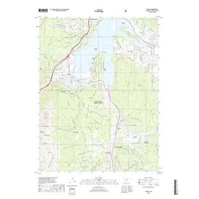
2019 Map of Frisco
USGS Topo · Published 2019About this map
Dillon Reservoir and the Blue River valley dominate this recreational and residential landscape, illustrating the modern character of Summit County. The map details the interconnected mountain towns of Silverthorne, Dillon, Frisco, and Breckenridge, showing a dense network of recreational infrastructure like the Dillon Reservoir Recpath and the Vail Pass/Tenmile Canyon National Recreational Trail. Evidence of the region's industrial past remains at the Superior Mine and the settlement of Masontown, while the presence of the White River National Forest and landmarks like Tenmile Peak and Buffalo Mountain define the topography. Researchers can trace the path of the Continental Divide National Scenic Trail as it winds through the peaks, alongside family-history markers at the Frisco Cem and Dillon Cem.
Find a feature on this map
79 named features on this map. Tap any name to fly to it.
Don’t see what you’re looking for? This feature index may not catch every label — zoom into the map to look around manually.
Map Details
Editions of this 2019 Frisco Map
This is the sole edition of this map. No revisions or reprints were ever made.
Other maps of this area

1889 · Leadville
USGS Topo · 1:125,000

1891 · Leadville
USGS Topo · 1:125,000

1924 · Montezuma
USGS Topo · 1:62,500

1926 · Montezuma
USGS Topo · 1:62,500

1929 · Dillon
USGS Topo · 1:62,500

1933 · Montezuma
USGS Topo · 1:62,500

1934 · Climax
USGS Topo · 1:48,000

1934 · Dillon
USGS Topo · 1:62,500

1937 · Como
USGS Topo · 1:62,500

1938 · Mt. Lincoln
USGS Topo · 1:48,000