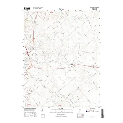
2016 Map of Fritchton
USGS Topo · Published 2016About this map
Fritchton and Verne serve as focal points for this agricultural region east of Vincennes, where the landscape is defined by a complex network of creeks and drainage systems. The Upper River Deshee and Williams Ditch dominate the southern portion of the map, illustrating the historical efforts to manage the low-lying drainage basins in Knox County. The area’s genealogical record is preserved at sites like Fritchton Cem, Root Cem, and Highland Cem, which sit among family-named thoroughfares such as Bruceville Rd and Grundman Rd. The presence of Marchino Field and the meandering paths of Pond Cr and Snapp Cr highlight the rural character of the territory during this period of the twenty-first century, reflecting a community rooted in its traditional land use and water management patterns.
Find a feature on this map
110 named features on this map. Tap any name to fly to it.
Don’t see what you’re looking for? This feature index may not catch every label — zoom into the map to look around manually.
Map Details
Editions of this 2016 Fritchton Map
This is the sole edition of this map. No revisions or reprints were ever made.
Other maps of this area

1915 · Vincennes
USGS Topo · 1:62,500

1917 · Birds
USGS Topo · 1:62,500

1942 · Fritchton
USGS Topo · 1:24,000

1942 · Birds
USGS Topo · 1:62,500

1943 · Oaktown
USGS Topo · 1:24,000

1943 · Bicknell
USGS Topo · 1:24,000

1944 · Fritchton
USGS Topo · 1:24,000

1944 · Monroe City
USGS Topo · 1:24,000

1944 · Wheatland
USGS Topo · 1:24,000

1944 · Iona
USGS Topo · 1:24,000