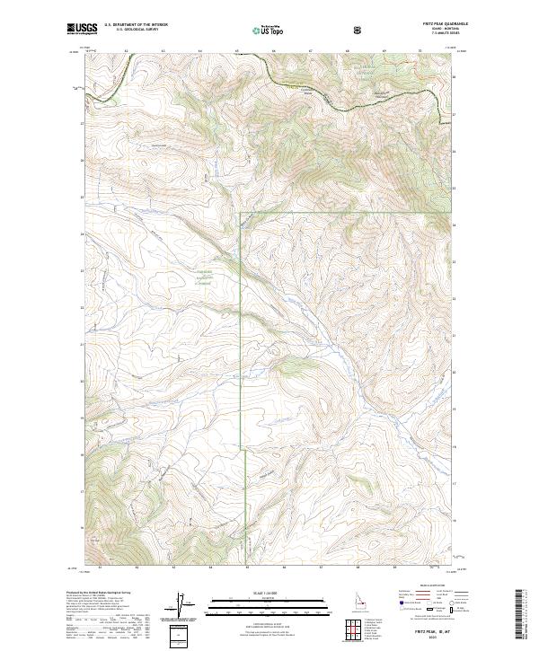
2023 Map of Fritz Peak
USGS Topo · Published 2023About this map
The Beaverhead Mountains define the high-altitude border between Idaho and Montana, where the Continental Divide winds through the northern portion of this region. This landscape is a corridor of historical movement, marked by the crossing at Bannack Pass and the path of the Emigrant Trail Rd in the south. The terrain is deeply incised by drainages such as Warm Creek and the multiple forks of Fritz Creek, which flow toward the Medicine Lodge Bench.
Find a feature on this map
41 named features on this map. Tap any name to fly to it.
Don’t see what you’re looking for? This feature index may not catch every label — zoom into the map to look around manually.
Map Details
Editions of this 2023 Fritz Peak Map
This is the sole edition of this map. No revisions or reprints were ever made.
Other maps of this area

1955 · Dubois
USGS Topo · 1:250,000

1957 · Scott Peak
USGS Topo · 1:62,500

1957 · Edie Ranch
USGS Topo · 1:62,500

1958 · Dubois
USGS Topo · 1:250,000

1965 · Caboose Canyon
USGS Topo · 1:24,000

1965 · Gallagher Gulch
USGS Topo · 1:24,000

1965 · Lima Peaks
USGS Topo · 1:24,000

1983 · Dubois
USGS Topo · 1:100,000
1987 · Deadman Lake
USGS Topo · 1:24,000
1987 · Fritz Peak
USGS Topo · 1:24,000