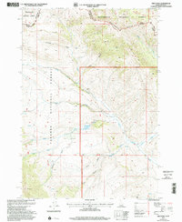
1997 Map of Fritz Peak
USGS Topo · Published 2002About this map
The Continental Divide defines the high-altitude boundary between Idaho and Montana in this high-country landscape recorded during the late 1990s. This transition between Beaverhead National Forest and Targhee National Forest centers on Fritz Peak, where a network of gulches and canyons, such as Poison Canyon and Limestone Gulch, drop away from the ridges. Evidence of historical resource exploration is scattered across the terrain in the form of several labeled Prospects and a Quarry near Warm Creek.
Find a feature on this map
34 named features on this map. Tap any name to fly to it.
Don’t see what you’re looking for? This feature index may not catch every label — zoom into the map to look around manually.
Map Details
Editions of this 1997 Fritz Peak Map
This is the sole edition of this map. No revisions or reprints were ever made.
Other maps of this area

1955 · Dubois
USGS Topo · 1:250,000

1957 · Scott Peak
USGS Topo · 1:62,500

1957 · Edie Ranch
USGS Topo · 1:62,500

1958 · Dubois
USGS Topo · 1:250,000

1965 · Caboose Canyon
USGS Topo · 1:24,000

1965 · Gallagher Gulch
USGS Topo · 1:24,000

1965 · Lima Peaks
USGS Topo · 1:24,000

1983 · Dubois
USGS Topo · 1:100,000
1987 · Deadman Lake
USGS Topo · 1:24,000
1987 · Fritz Peak
USGS Topo · 1:24,000