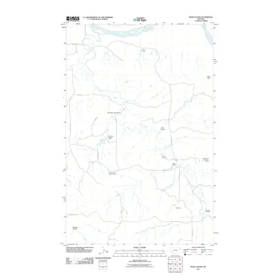
2011 Map of Frog Coulee
USGS Topo · Published 2011About this map
The Missouri River defines the northern edge of this landscape in Roosevelt County, where the high plains are carved by a complex network of coulees and drainage systems. This 2011 survey illustrates a region shaped by agricultural management and early 21st-century rural infrastructure, notably the irrigation and water management structures such as Harfo Dam, Foss Dam, and R Schmitz Number 1 Dam. The terrain is marked by distinctive formations like Balls Bluff and deep-cut valleys including Promised Land Coulee and Big Basin Coulee. Cultural history is anchored by sites like the Saint Bernards Church Cemetery and Lynd Cemetery, which serve as quiet markers of the community's ancestral footprint. A network of rural routes, including County Rd 321 and Road 146, provides access across the drainage of Charlie Creek and Charley Creek, mapping out the modern persistence of this prairie geography.
Find a feature on this map
23 named features on this map. Tap any name to fly to it.
Don’t see what you’re looking for? This feature index may not catch every label — zoom into the map to look around manually.
Map Details
Editions of this 2011 Frog Coulee Map
This is the sole edition of this map. No revisions or reprints were ever made.
Other maps of this area

1909 · Glendive
USGS Topo · 1:250,000

1914 · Brockton
USGS Topo · 1:62,500

1948 · Fort Kipp
USGS Topo · 1:24,000

1949 · Fort Kipp
USGS Topo · 1:24,000

1950 · Calais
USGS Topo · 1:24,000

1954 · Glendive
USGS Topo · 1:250,000

1954 · Wolf Point
USGS Topo · 1:250,000

1957 · Glendive
USGS Topo · 1:250,000

1958 · Wolf Point
USGS Topo · 1:250,000

1958 · Glendive
USGS Topo · 1:250,000