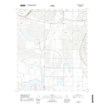
2018 Map of Frogmore
USGS Topo · Published 2018About this map
The alluvial plains of Concordia and Catahoula Parishes are defined by a complex network of waterways, where the Tensas River and Bayou Cocodrie carve through the landscape. This 2018 survey illustrates a region shaped by its hydrology, featuring numerous secondary channels such as Brushy Bayou and Carey Bayou, alongside distinctive wetlands like Cypress Brake and Ross Brake. The settlement pattern follows the high ground near these water bodies, with the communities of Stacy and Frogmore situated along Louisiana Ave. Genealogists will find notable burial sites including Mount Moriah Cem, Athlone Cem, and Warren Cem. The southern portion of the map is dominated by the winding path of Kenyon Bayou and the prominent Horse Shoe Island, illustrating the shifting nature of the local river systems over time.
Find a feature on this map
86 named features on this map. Tap any name to fly to it.
Don’t see what you’re looking for? This feature index may not catch every label — zoom into the map to look around manually.
Map Details
Editions of this 2018 Frogmore Map
This is the sole edition of this map. No revisions or reprints were ever made.
Other maps of this area

1909 · Sycamore Landing
USGS Topo · 1:24,000

1935 · Tooleys
USGS Topo · 1:62,500

1939 · Red Gum
USGS Topo · 1:62,500

1939 · Deer Park
USGS Topo · 1:62,500

1941 · Manifest
USGS Topo · 1:62,500

1941 · Tooleys
USGS Topo · 1:62,500

1953 · Natchez
USGS Topo · 1:250,000

1956 · Natchez
USGS Topo · 1:250,000

1959 · Natchez
USGS Topo · 1:250,000

1960 · Jonesville
USGS Topo · 1:62,500