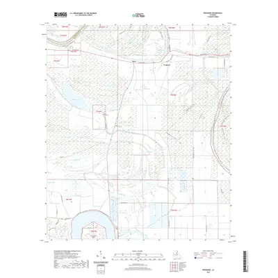
2020 Map of Frogmore
USGS Topo · Published 2020About this map
Frogmore and Stacy anchor this survey of the low-lying wetlands of Concordia and Catahoula Parishes. The landscape is defined by an intricate network of water bodies, where the Tensas River and Bayou Cocodrie snake through dense brakes and bayous. Local history is preserved in several small burial grounds, including Athlone Cem near the river and Mount Moriah Cem situated near the parish line. The map highlights the agrarian and recreational nature of the region, featuring Frogmore Plantation Rd and a system of trails such as the Cross Bayou Unit Atv Trail. South of the main settlements, the terrain becomes increasingly aqueous, characterized by Parish Lake and Horse Shoe Island, illustrating the complex hydrology of the Mississippi Delta's backwaters.
Find a feature on this map
56 named features on this map. Tap any name to fly to it.
Don’t see what you’re looking for? This feature index may not catch every label — zoom into the map to look around manually.
Map Details
Editions of this 2020 Frogmore Map
This is the sole edition of this map. No revisions or reprints were ever made.
Other maps of this area

1909 · Sycamore Landing
USGS Topo · 1:24,000

1935 · Tooleys
USGS Topo · 1:62,500

1939 · Red Gum
USGS Topo · 1:62,500

1939 · Deer Park
USGS Topo · 1:62,500

1941 · Manifest
USGS Topo · 1:62,500

1941 · Tooleys
USGS Topo · 1:62,500

1953 · Natchez
USGS Topo · 1:250,000

1956 · Natchez
USGS Topo · 1:250,000

1959 · Natchez
USGS Topo · 1:250,000

1960 · Jonesville
USGS Topo · 1:62,500