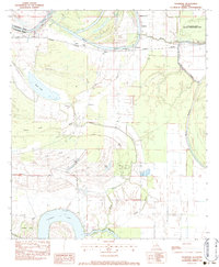
1983 Map of Frogmore
USGS Topo · Published 1983About this map
Hydrological patterns and agricultural land define this section of Concordia Parish and Catahoula Parish, where the Tensas River and numerous bayous weave through the bottomlands. The landscape is dotted with several rural churches and cemeteries, such as St James Ch and the New Daughter Ch Cem, serving small settlements like Athlone and Stacy. The era's industrial footprint is visible through the Float Oil Field and wooden pole transmission lines crossing the terrain.
Find a feature on this map
41 named features on this map. Tap any name to fly to it.
Don’t see what you’re looking for? This feature index may not catch every label — zoom into the map to look around manually.
Map Details
Editions of this 1983 Frogmore Map
This is the sole edition of this map. No revisions or reprints were ever made.
Other maps of this area

1909 · Sycamore Landing
USGS Topo · 1:24,000

1935 · Tooleys
USGS Topo · 1:62,500

1939 · Red Gum
USGS Topo · 1:62,500

1939 · Deer Park
USGS Topo · 1:62,500

1941 · Manifest
USGS Topo · 1:62,500

1941 · Tooleys
USGS Topo · 1:62,500

1953 · Natchez
USGS Topo · 1:250,000

1956 · Natchez
USGS Topo · 1:250,000

1959 · Natchez
USGS Topo · 1:250,000

1960 · Jonesville
USGS Topo · 1:62,500