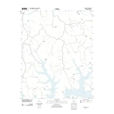
2011 Map of Frogue
USGS Topo · Published 2011About this map
Dale Hollow Lake dominates the southern landscape of this region, its branching fingers reaching into numerous valleys such as Bend Hollow and Jackson Hollow. The terrain is defined by a series of sharp ridges and deep hollows, typical of the Cumberland River basin. To the north, the Cumberland River itself winds through the territory near Neeleys Ferry, while numerous smaller waterways like Clover Creek and Raft Creek drain the surrounding highlands. This 2011 survey captures the area at a time when recreational landmarks like Trooper Island and Boys Island have become central to the local geography. Significant genealogical markers remain visible across the rural landscape, including Vincent Cemetery in the northeast and Long Cemetery situated on a rise above the lake's northern shore. The road network, including Old Frogue - Albany Rd, connects these remote settlements and family-named hollows like Dickens Hollow and Spurlins Hollow.
Find a feature on this map
66 named features on this map. Tap any name to fly to it.
Don’t see what you’re looking for? This feature index may not catch every label — zoom into the map to look around manually.
Map Details
Editions of this 2011 Frogue Map
This is the sole edition of this map. No revisions or reprints were ever made.
Other maps of this area

1924 · Lillydale
USGS Topo · 1:62,500

1926 · Lillydale
USGS Topo · 1:62,500

1929 · Lillydale
USGS Topo · 1:62,500

1929 · Byrdstown
USGS Topo · 1:62,500

1953 · Waterview
USGS Topo · 1:24,000

1953 · Burkesville
USGS Topo · 1:24,000

1953 · Wolf Creek Dam
USGS Topo · 1:24,000

1954 · Frogue
USGS Topo · 1:24,000

1954 · Blacks Ferry
USGS Topo · 1:24,000

1954 · Albany
USGS Topo · 1:24,000