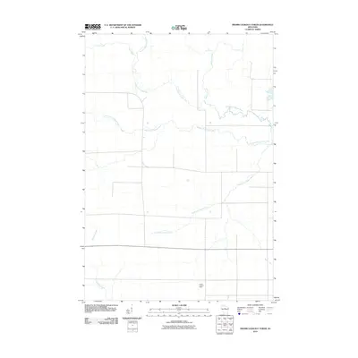
2010 Map of Fromm Lookout Tower
USGS Topo · Published 2010About this map
Fromm Lookout Tower stands as a prominent landmark in this corner of Lincoln County, overlooking a landscape defined by the branching waterways of the Copper River system. The map details the drainage patterns of the North Fork Copper River, Middle Fork Copper River, and South Fork Copper River, which snake across the terrain alongside smaller tributaries like Prast Creek and McGinnis Creek. The rectilinear road network imposed upon this watershed highlights the intersection of natural hydrology and systematic land division typical of northern Wisconsin. In the lower right, the appearance of Devils Creek completes the picture of a territory heavily influenced by its creek beds and river forks, where elevation and water access likely dictated early settlement and land use.
Find a feature on this map
7 named features on this map. Tap any name to fly to it.
Don’t see what you’re looking for? This feature index may not catch every label — zoom into the map to look around manually.
Map Details
Editions of this 2010 Fromm Lookout Tower Map
This is the sole edition of this map. No revisions or reprints were ever made.
Other maps of this area

1902 · Marathon
USGS Topo · 1:125,000

1945 · Rib Lake
USGS Topo · 1:48,000

1947 · Rib Lake
USGS Topo · 1:48,000

1949 · Rib Lake
USGS Topo · 1:48,000

1950 · Spirit Falls
USGS Topo · 1:48,000

1951 · Athens
USGS Topo · 1:48,000

1951 · Hamburg
USGS Topo · 1:48,000

1952 · Spirit Falls
USGS Topo · 1:48,000

1953 · Rice Lake
USGS Topo · 1:250,000

1954 · Iron Mountain
USGS Topo · 1:250,000