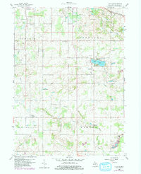
1959 Map of Frontier
USGS Topo · Published 1979About this map
Agricultural and recreation patterns in southern Hillsdale County appear in high detail on this mid-century survey. Small settlements like Frontier and Ransom anchor the southern townships, while the northern portion of the sheet is defined by the New York Central railroad corridor and the glacial hydrology of the East Branch St. Joseph River. The landscape is dotted with small-scale industry in the form of numerous Gravel Pits, alongside several family and community burial grounds including Morgan Cem and Wild Cherry Cem.
Find a feature on this map
32 named features on this map. Tap any name to fly to it.
Don’t see what you’re looking for? This feature index may not catch every label — zoom into the map to look around manually.
Map Details
Editions of this 1959 Frontier Map
2 editions found
Other maps of this area

1913 · Alvordton
USGS Topo · 1:62,500

1914 · Pioneer
USGS Topo · 1:62,500

1944 · Pioneer
USGS Topo · 1:62,500

1944 · Alvordton
USGS Topo · 1:62,500

1953 · Fort Wayne
USGS Topo · 1:250,000

1956 · Fort Wayne
USGS Topo · 1:250,000

1959 · Hillsdale
USGS Topo · 1:24,000

1959 · Reading
USGS Topo · 1:24,000

1959 · North Adams
USGS Topo · 1:24,000

1959 · Frontier
USGS Topo · 1:24,000