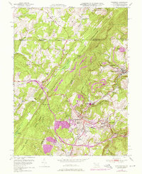
1949 Map of Frostburg
USGS Topo · Published 1976About this map
The Mason and Dixon Line defines the northern boundary of this Maryland coal-country survey, where the heavy industry of the Allegany highlands meets the ridge-and-valley terrain of the Savage River State Forest. The town of Frostburg serves as a regional hub, anchored by the Frostburg State Teachers College and the intersection of the historic National Road with the Western Maryland railroad lines.
Find a feature on this map
59 named features on this map. Tap any name to fly to it.
Don’t see what you’re looking for? This feature index may not catch every label — zoom into the map to look around manually.
Map Details
Editions of this 1949 Frostburg Map
3 editions found
Other maps of this area

1898 · Frostburg
USGS Topo · 1:62,500

1899 · Grantsville
USGS Topo · 1:62,500

1901 · Frostburg
USGS Topo · 1:62,500

1904 · Grantsville
USGS Topo · 1:62,500

1908 · Frostburg
USGS Topo · 1:62,500

1921 · Meyersdale
USGS Topo · 1:62,500

1923 · Berlin
USGS Topo · 1:48,000

1929 · Berlin
USGS Topo · 1:62,500

1939 · Meyersdale
USGS Topo · 1:62,500

1944 · Berlin
USGS Topo · 1:62,500