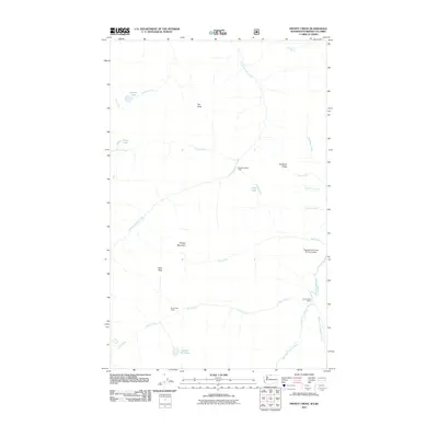
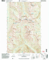
2011 Map of Frosty Creek
USGS Topo · Published 2011About this map
The Pasayten-US Forest Service Airfield serves as a distinct center of human activity in this high-altitude landscape of the northern Cascades. A network of creeks and rivers, including the West Fork Pasayten River and the Middle Fork Pasayten River, converges near the Three Forks Cabin to form the main Pasayten River. The terrain is defined by prominent elevations such as Smoky Mountain and Holdover Ridge, with numerous high-country lakes like Heather Lake and Lake of the Pines pocketed among the peaks. Evidence of mountain passage and remote habitation is found at sites like Chuchuwanteen Cabin and Brown Bear Camp, illustrating the area's role in forest management and backcountry recreation during the early twenty-first century.
Find a feature on this map
26 named features on this map. Tap any name to fly to it.
Don’t see what you’re looking for? This feature index may not catch every label — zoom into the map to look around manually.
Map Details
Editions of this 2011 Frosty Creek Map
This is the sole edition of this map. No revisions or reprints were ever made.
Other maps of this area

1920 · Slate Pass
USGS Topo · 1:125,000

1955 · Concrete
USGS Topo · 1:250,000

1958 · Concrete
USGS Topo · 1:250,000

1962 · Concrete
USGS Topo · 1:250,000

1969 · Frosty Creek
USGS Topo · 1:24,000
1969 · Pasayten Peak
USGS Topo · 1:24,000

1969 · Tatoosh Buttes
USGS Topo · 1:24,000
1969 · Shull Mtn.
USGS Topo · 1:24,000
1969 · Mount Lago
USGS Topo · 1:24,000
2002 · Mount Lago
USGS Topo · 1:24,000